The “unbreakable and rock-solid” China-Pakistan relationship appears to be extending beyond the land, sea, and air domains into orbital space, an increasingly critical arena for embedding alliances and projecting power. From the launch of Pakistan’s Badar-1 satellite in 1990, space cooperation between the two countries has undergone a significant transformation, now extending to the integration of Chinese navigation systems and the participation of Pakistani astronauts aboard the Tiangong space station. However, this civilian and developmental collaboration may also have implications for the regional security paradigm in South Asia, which increasingly depends on technological superiority, control over information, and multi-domain integration.
The increasing space cooperation between Beijing and Islamabad could thus be seen as a deeper structural shift transitioning their long-standing “all-weather” relationship into what could more accurately be described as an “all-domain” partnership. The embedding of Pakistan within China’s expanding space ecosystem points to a more networked and technologically mediated security landscape that shifts the regional security picture away from bilateral standoffs to a more complex multi-domain security dilemma. This collaboration could also possibly neutralize India’s conventional geographical advantages and crisis-management methods. This article traces the growth of deepening Pakistan-China space cooperation and its impact on India and strategic competition in South Asia writ large.
From Development Cooperation to Integrated Capability
China-Pakistan space cooperation has evolved gradually over the years. Initial collaborations include China’s assistance in the launch of an experimental satellite developed by Pakistan’s Space and Upper Atmosphere Research Commission (SUPARCO) in 1991, and another satellite, Badr-B, in 2001. Over the decades, China became Pakistan’s principal partner in the development of satellites and launch services, institutionalized through frameworks such as the 2012-2020 cooperation roadmap between SUPARCO and China National Space Administration (CNSA). The partnership expanded through the launch of several communication, remote sensing, and earth observation satellites, such as PAKSAT-IR, PRSS-1, PakTES-1A, iCube-Qamar, and PAKSAT-MM1. More recently, the cooperation has extended to include human spaceflight, with Pakistani astronauts receiving training for missions aboard China’s Tiangong space station. This reflects the deepening strategic trust between the two countries.
However, what distinguishes the early phase of China-Pakistan space cooperation from the present day is the deepened integration that goes beyond discrete projects toward systemic integration across multiple domains. This shift is most clear in Pakistan’s switch from the U.S. Global Positioning System (GPS) to China’s BeiDou system in 2014, the first country outside of China to do so. Pakistan’s reliance on GPS had raised concerns within its strategic community that the United States could restrict access to the navigational system in the case of a future conflict with India, informed in part by its experience in the Kargil war, when the U.S reportedly provided satellite access to help India intercept communications between senior Pakistani military leadership. Pakistan’s access to BeiDou certainly reduces its dependence on external systems and enhances its own operational autonomy, but it can also be seen as an instrument of its deepening strategic alignment with China.
However, what distinguishes the early phase of China-Pakistan space cooperation from the present day is the deepened integration that goes beyond discrete projects toward systemic integration across multiple domains.
This is because, unlike other global navigation satellite system (GNSS) constellations, BeiDou is inherently dual-use; it combines positioning data with short messaging through its RNSS and RDSS services, enabling users to transmit and receive messages in remote environments. Indeed, under a bilateral military agreement, Pakistan became the only country permitted to use BeiDou’s restricted service, which provides encrypted signals along with real-time data. Rather than a standalone technological shift, this level of access embeds Pakistan within a Chinese-controlled ecosystem, wherein satellite navigation is linked with communications, intelligence sharing, and ground-based infrastructure, such as the planned Continuously Operating Reference Station (CORS) network, a ground-based reference system that improves positioning accuracy and enables continuous geospatial data collection.
Taken together, these developments indicate a shift toward a more integrated China-Pakistan space partnership in which space-based assets, ground infrastructure, and human capital are increasingly interlinked.
The China-Pakistan Axis: In the Orbital Dimension and Beyond
The China-Pakistan space nexus should be understood as the integration of space-enabled capabilities into a wider, networked operational architecture. China’s reported transfer of the SLC-18 Active Electronically Scanned Array (AESA) radar, a system designed to detect and track satellites in Low Earth Orbit and ballistic missiles over extended ranges, to Pakistan is indicative of this expanding security architecture; Indian sources evince concern that data generated by this system may also be shared with China, though there has been no public confirmation of such data sharing.
Within this framework, one of the most consequential impacts of China-Pakistan space cooperation is the integration of Intelligence, Surveillance and Reconnaissance (ISR), navigation, and communication into a shared operational framework. This is where Pakistan’s BeiDou integration could well come into play: BeiDou-enabled positioning, along with Chinese-supported satellite platforms and ground infrastructure, enables the acquisition of real-time data and their effective transmission and coordination. At the same time, these technologies have a dual-use nature. For instance, BeiDou’s two-way messaging feature can reveal a user’s location and other data, enabling user tracking. In a conflict scenario, these capabilities could enable more precise targeting, better battlefield awareness and even identification of troop movements.
These developments can be understood within the broader framework of multi-domain warfare (MDW), which China has actively embraced. MDW aims to enhance conventional warfighting effectiveness by integrating operations across domains such as space, cyber, electromagnetic, and information. Pakistan has increasingly sought to align with this approach: Joint exercises such as Shaheen air drills reflect multidimensional operational integration, and emerging reports from Indian sources point to China-supported initiatives in Pakistan, such as the Centre for Artificial Intelligence and Computing (CENTAIC), that could serve as a possible source of additional support to Pakistan in a future military conflict with India, including in real-time data sharing, AI-assisted targeting, and enhanced strike responsiveness.
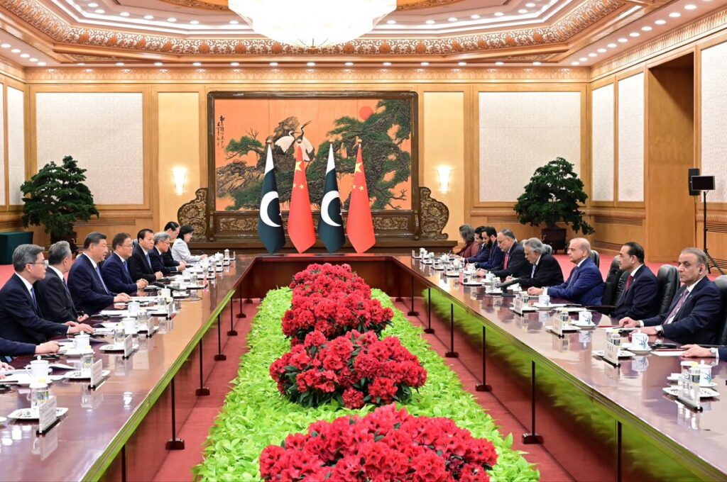
These developments suggest that China–Pakistan cooperation is expanding well beyond orbital collaboration into a more integrated, cross-domain framework that combines shared intelligence, coordinated cyber operations, electromagnetic spectrum activities, and emerging tools such as AI-driven information operations. This creates a highly complex security environment in which threats are not confined to traditional military domains, but extend into critical infrastructure and digital networks. The reported breaches of India’s power grids and banking systems in 2024 offer a glimpse of how future attacks may unfold, making attribution increasingly difficult.
India’s Challenges Rise from Two Fronts to Multiple Domains
India’s strategic community has long been concerned about the prospect of a two-front war, involving simultaneous military pressure from China along the northern borders and Pakistan along the western front. The deepening of the China-Pakistan strategic partnership could transform this challenge from a geographically defined, two-front problem into a more networked, multi-domain security environment. A glimpse of what China-Pakistan cooperation may entail for India was visible during Operation Sindoor, where China reportedly facilitated Pakistan’s response by using a using a BeiDou-enabled satellite network to provide targeting, tracking, and fire-control data, enabling Pakistani systems to engage targets with greater precision across the Line of Control.
As interoperability between China and Pakistan deepens, India is likely to face a new range of security challenges, including potential asymmetry in the field of ISR. Satellite imagery and real-time data are crucial for situational awareness; if China and Pakistan were to integrate their space-based ISR capabilities, it could create potential gaps in India’s capacity to monitor and respond effectively. A second challenge is the impact of BeiDou integration on Pakistan’s precision warfare capabilities. BeiDou’s access to precise geospatial data can significantly enhance the targeting efficiency of missiles, drones, and other precision-guided systems, thereby strengthening Pakistan’s overall warfare capabilities.
India, however, is advancing its own efforts to integrate space capabilities into military operations. Since the early 2000s, it has deployed a range of dual-use satellites and developed systems such as NavIC and GAGAN, while also launching dedicated military assets including GSAT-7, GSAT-7A, and an Electromagnetic Intelligence satellite. Notably, it demonstrated counterspace capability through the 2019 Mission Shakti ASAT test. To strengthen its space-based surveillance capabilities, in 2024 India’s Cabinet Committee on Security approved a decade-long initiative to launch 52 surveillance satellites. Complementing these technological developments, India’s naval doctrine (IMD-25), released in 2025, underscores the importance of Multi-Domain Operations (MDO), identifying land, sea, air, space and cyber domains as critical arenas of warfare and emphasizing the need for their integrated and synchronized use.
Taken all together, it is clear that evolving geopolitical competition in South Asia is increasingly characterized by mutual efforts to offset and balance capabilities. While Pakistan seeks to narrow its own asymmetries vis-à-vis India through its partnership with China, India must simultaneously manage the combined and evolving capabilities of both adversaries. Given the growing challenges of attribution and the opaque nature of emerging technologies, these dynamics are intensifying the security dilemma and complicating regional stability.
Space Integration and Strategic Stability in South Asia
The deepening of China-Pakistan space cooperation poses critical threats to South Asia’s strategic stability. The technical complexities and dual-use nature of space capabilities make it difficult to assess capabilities and intentions. Actions in space are also difficult to attribute with certainty as capabilities are diffused across actors and domains, creating ambiguities about who can be held responsible and similarly complicating response mechanisms.
The deepening of the China-Pakistan strategic partnership could transform this challenge from a geographically defined, two-front problem into a more networked, multi-domain security environment.
Escalation risks are also incredibly high in the space domain, with no clear norms defining what constitutes an act of war in space. This makes the risk of miscalculation even more acute. Such dangers are already visible in contested geopolitical theatres like the South China Sea, where satellite-enabled maritime domain awareness has enabled persistent tracking and grey-zone coercion without triggering open conflict. As states increasingly integrate space-based ISR, navigation, and communication systems into military operations, a similar dynamic is likely to emerge in South Asia.
India and South Asia’s New Strategic Geography
The emerging security order in South Asia is one in which the lines between cooperation and competition, and between civilian and military spheres, are increasingly blurred. With the transformation of China–Pakistan cooperation from an “all-weather” to an “all-domain” partnership, space becomes central to how power is projected, shared, and contested in the region. For India, responding to this shift will require both technological investment and conceptual innovation.
First, India must strengthen its space-based ISR capabilities by accelerating the deployment of its planned surveillance constellations. Additionally, it should enhance data fusion across its existing institutional nodes, such as the Information Fusion Centre-Indian Ocean Region (IFC-IOR), the Integrated Command and Control System, and the Battlefield Surveillance System, to reduce gaps in real-time surveillance and data integration. Second, it should build greater operational autonomy by expanding indigenous navigation and communication systems, such as NavIC and military satellite networks, such as GSAT-7 and GSAT-7A. Third, India should enhance its deterrence by further developing counter-space and electronic warfare capabilities, integrating its demonstrated ASAT capabilities into a multi-domain operational framework. Finally, as a key regional power, India should also play a proactive role in shaping norms on responsible behavior in the space domain by leveraging platforms such as SAARC and Colombo Security Conclave. These regional groupings can be utilized to promote transparency, facilitate information-sharing and build confidence among member states. As space technologies reshape the regional security landscape, establishing such norms will be critical in managing the emerging security trilemma among India, Pakistan, and China.
Views expressed are the author’s own and do not necessarily reflect the positions of South Asian Voices, the Stimson Center, or our supporters.
Also Read: Why China Isn’t Worried about the U.S.-Pakistan Honeymoon
***
Image 1: SUPARCO
Image 2: Shehbaz Sharif on X